Shires, Hundreds and the HalfShire
SHIRE. The use of the term ‘shire’ dates back to Anglo Saxon times and was commonly used in the ancient earldoms of Wessex, Mercia, Northumbria and East Anglia. Our shires would have originally formed part of Mercia and came into being some time after 900 and 1016. Shires formed the basis of the King’s authority and were presided over by ‘shire-reeves’ or sheriffs, who collected fines and fees, presiding over courts to hear disputes, largely involving land.
This shire structure that was in place by the time of the Norman Conquest in 1066 was to largely remain in place until 1974.
HUNDREDS. Underneath the larger areas covered by the shires and managed by the sheriffs, a much more local form of ‘government’ or administration was needed– these were known as ‘the hundreds.’ The term hundred as used here was the division of a shire for administrative, military and judicial purposes under the common law. The hundred is said to have been a portion of land large enough to sustain approximately one hundred households or ‘hides.’ Historians state the hundreds were also used to assist the King in raising men for ships and battle. Local Hundreds Courts presided over land and legal issues.
HALFSHIRE. The ‘Halfshire’ was one of the 12 hundreds in Worcestershire as recorded at the time of that great landmark survey, the ‘Domesday Book’ of 1086. The ‘Halfshire Hundred’ was unusual as it did not have a single owner or group of owners and included; Dudley, Stourbridge, Hagley, Pedmore, Oldswinford, Kidderminster, Bromsgrove and Droitwich amongst others.
The Border Shift
The 1972 Local Government Act had major impacts on the old Midland Shires, with the old county edges of Worcestershire, South Staffordshire and North Warwickshire and the ‘last homely house’ swept into and pinned back by the creation of the new West Midlands County Council , with Birmingham, at its beating heart.
Crucially, Stourbridge, Halesowen and Warley were sliced away from Worcestershire after hundreds of years – the old ‘Halfshire Hundred’ was dead and gone. Dudley, which had been ceded to Staffordshire from Worcestershire in 1966, was also added to the sprawling new region. The ancient Domesday parish of Kingswinford was split apart ( we aren’t bitter honest- Editors). Land that for centuries had been part of the ancient shires was transferred to an ever growing industrial conurbation pushing at the Greenbelt far west of Birmingham, as it still does.
Other key changes from 1974 were that Herefordshire and Worcestershire were conjoined – it didn’t last.
In these pages, we are focussed on the history and culture lines of the old borders -it’s like 1972 never happened.
Old Shire Maps
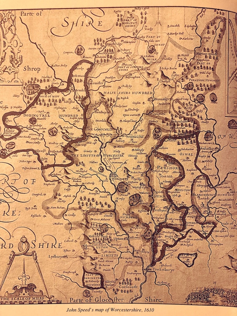
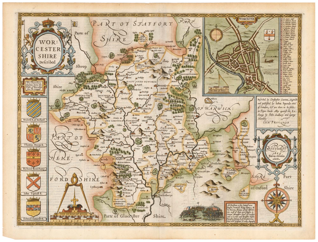
In this section, we focus on John Speed’s wonderful county maps, dawn in early seventeenth century England. It was Speed’s wonderful Worcestershire maps that have us the inspiration to start this site and to write about these old lands.
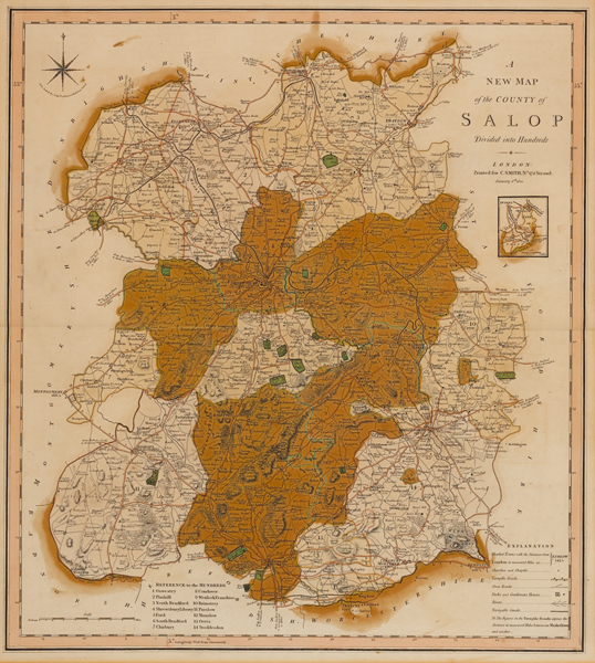
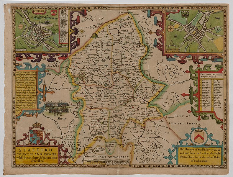
Speed is one of the greatest cartographers in history, giving England its first atlas, ‘The Theatre of Great Britaine,’ published in 1611. Below are the maps for Worcestershire, Staffordshire and Salop/Shropshire, produced by Speed for this book and showing the shires as they were at the end of Elizabeth I’s reign.
It is interesting to note how Dudley was an ‘island ‘dislocated from the rest of Worcestershire, Also we see Halesowen as historically part of Salop/Shropshire.